01
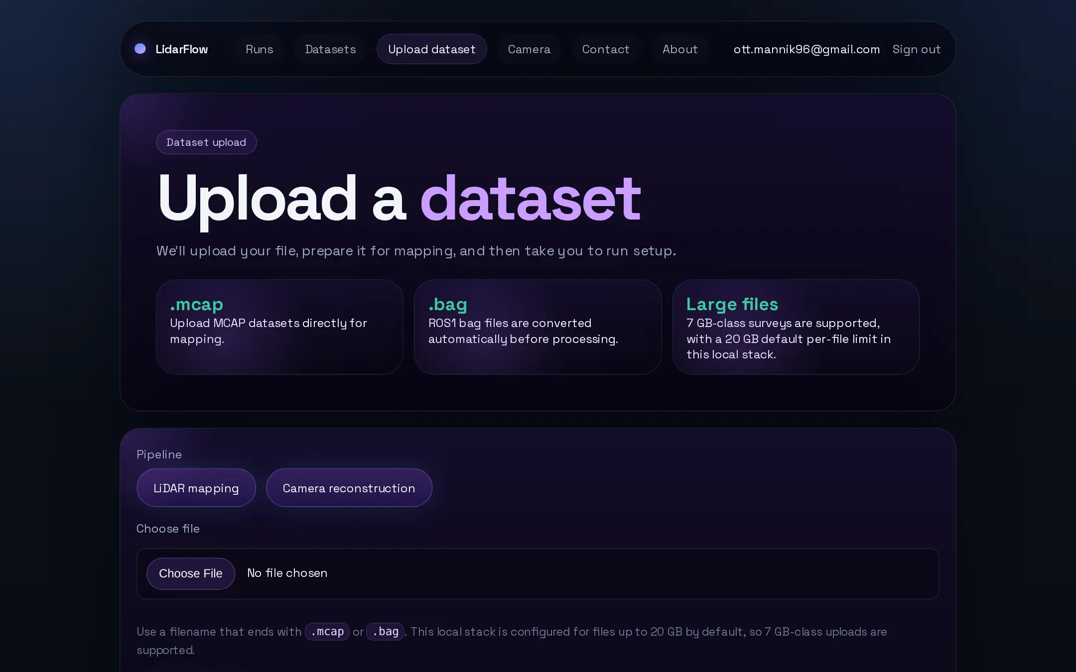
Upload the recording
Start with a `.mcap` or ROS1 `.bag`. The uploader shows transfer progress first, then a short server-side prepare step while LidarFlow scans the recording's topics and sensors.
The flow is straightforward: upload the recording, pick your sensors, reconstruct in 3D from LiDAR or a single camera, georeference the output when GNSS exists, and review the artifacts — all in one browser workflow.
Start with a `.mcap` or ROS1 `.bag`. The uploader shows transfer progress first, then a short server-side prepare step while LidarFlow scans the recording's topics and sensors.
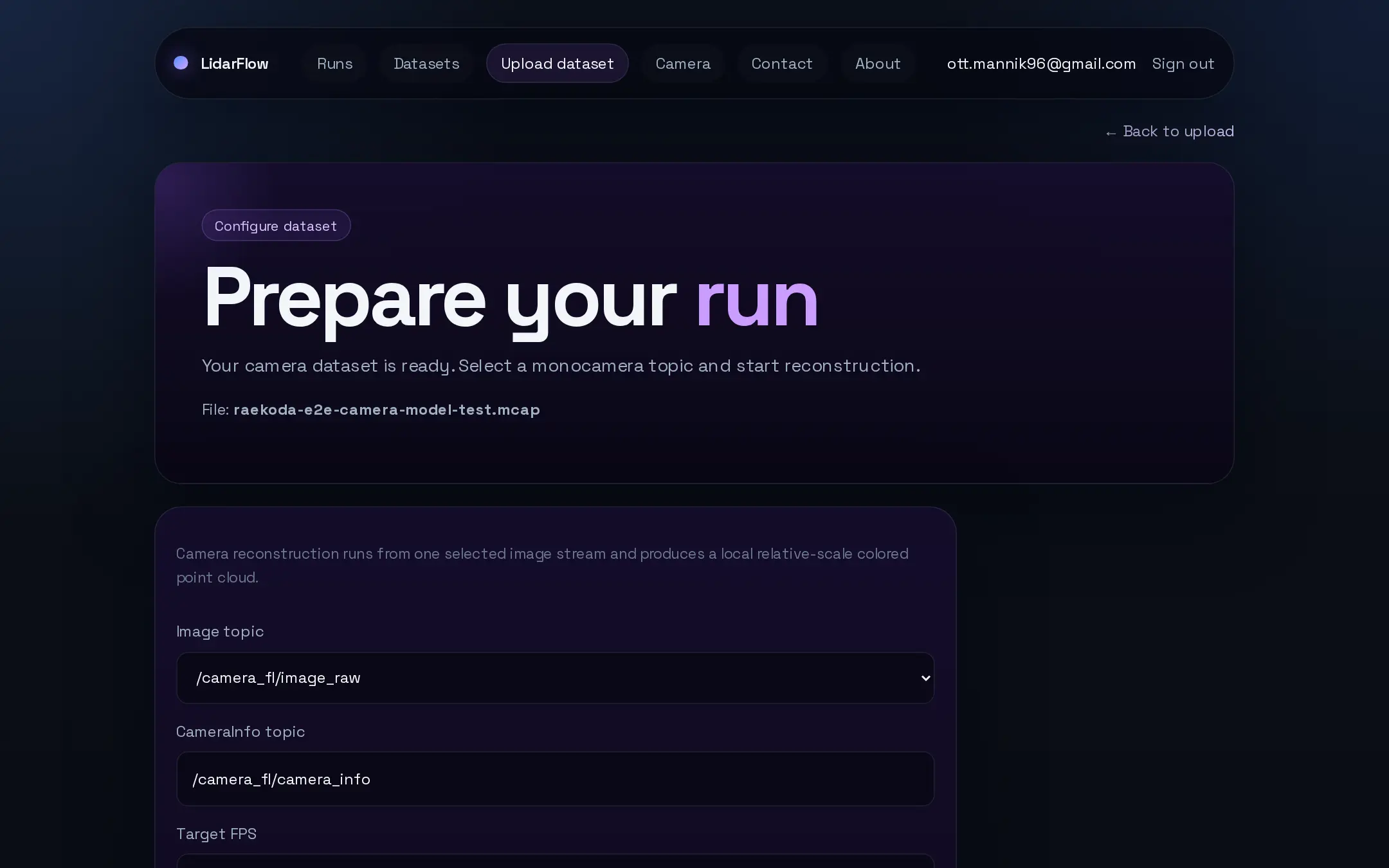
LidarFlow detects what's in the bag — LiDAR, GNSS, IMU, `/tf_static`, and any cameras with their intrinsics — and you choose what to reconstruct from: LiDAR, a single camera, or both.
The LiDAR path runs GLIM SLAM; the camera path runs monocular metric depth to lift a single video stream into a metric point cloud. Either way the browser shows queue and worker health instead of leaving you to guess.
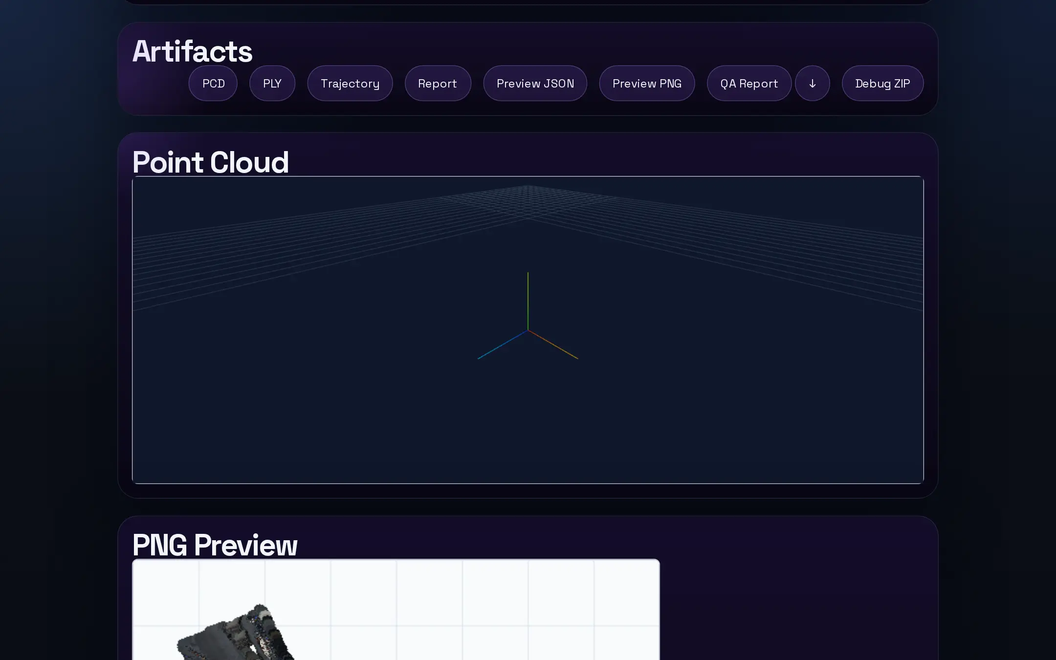
When GNSS is present, FlexCloud aligns the result to real-world coordinates. You get an in-browser preview and downloadable PCD/LAS/PLY artifacts.
Engineers want to know what stack is running underneath the UI, and they should. LidarFlow makes that explicit instead of hiding it behind vague platform language.
bag_to_pcd locally?Because exporting timestamped point clouds is not the same job as building a mapped output. Local tools are still useful when you only need raw frames, but they stop short of a reproducible, browser-reviewable map.
ros2 run pcl_ros bag_to_pcd --ros-args \
  -p bag_path:=rosbag2_2025_01_01/ \
  -p topic_name:=/pointcloud \
  -p output_directory:=pcds
That upstream utility exports PCD frames for one topic. It does not validate your TF tree, run LiDAR SLAM, or georeference the result.
Not exactly. `bag_to_pcd` exports frame-by-frame point clouds. LidarFlow is for the next job: turning the recording into one mapped output you can review and download.
GLIM drives the LiDAR SLAM step. FlexCloud handles the GNSS-backed georeferencing step after the SLAM map exists.
The upload can still move forward as long as it has LiDAR. You still get a SLAM map; the only thing you lose is the georeferenced alignment.